Study of Land Use Map
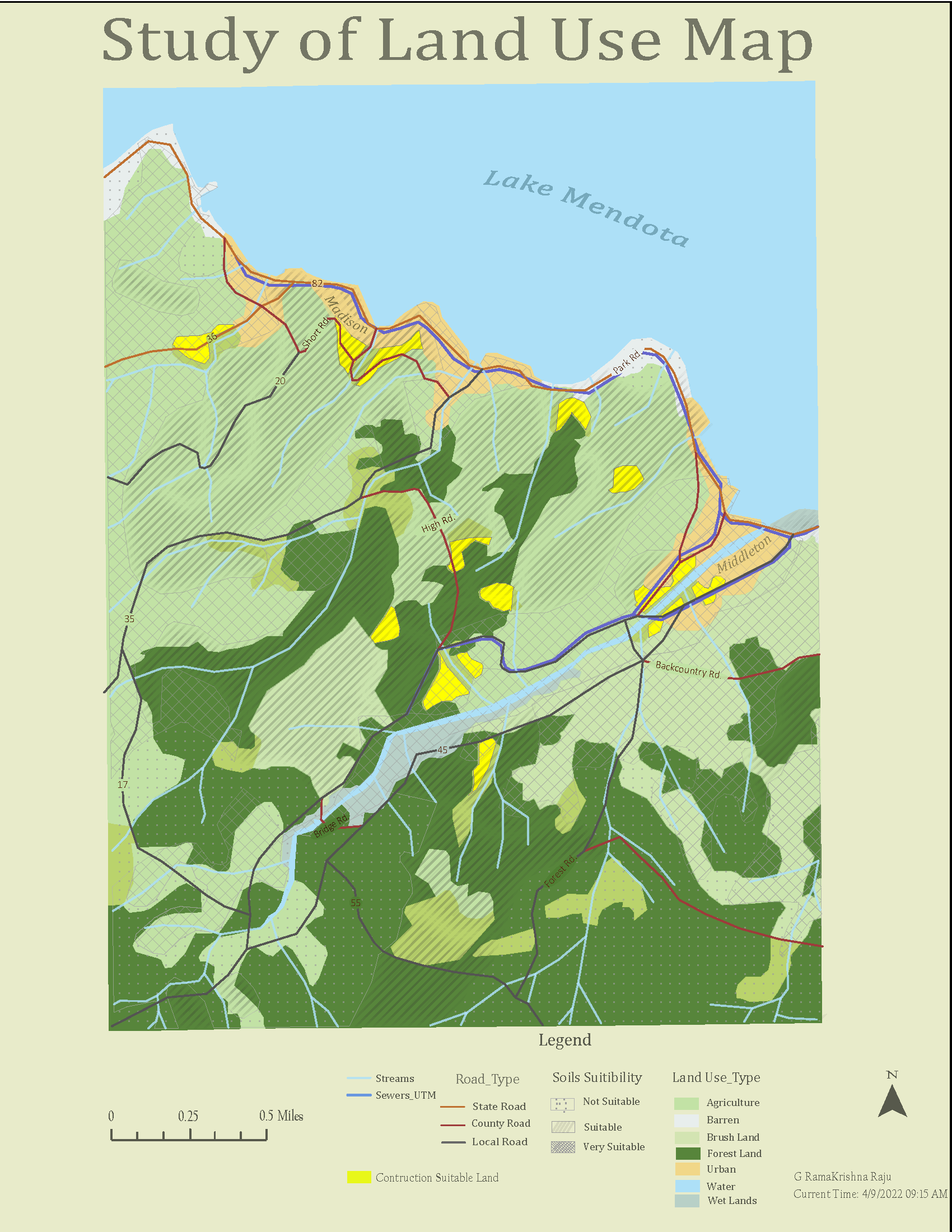
A map of potential sites analysis under the vector data model. The purpose of our project is to locate potential sites for constructing a small lab and office building near a coastal farming area to perform research and extension projects in aquaculture. The site must meet the following constraints:
A local ordinance designed to prevent rampant development only allows new construction within 300 meters of existing sewer lines.
A recent national water quality act requires that NO construction occurs within 20 meters of streams.
The site should not be forested (eliminating the cost of clearing land). And, because a regional agricultural preservation plan prohibits converting farmland in this area, the current land use must be brush land.
The site must overlie soils suitable for buildings.
The site must be at least 2,000 square meters in size
Based on the above constraints the suitable land use map is generated using ArcGIS tool for spatial analysis and Adobe illustrator for grahic design